By: Jason Edwards
Hikers and outdoor enthusiasts need look no farther for a fun adventure than the East Coast Trail, embracing all of her rugged beauty and charm
=====
 In a trail system usually described with superlatives the Spout/Motion Head Path stands alone. Straddling the halfway mark between Portugal Cove and Cappahayden this path has become, in many ways, the heart of the East Coast Trail and is one of its most recognizable paths. It is often the first long hike that new hikers will undertake and the first overnight adventure. It is also the halfway point for hikers looking to conquer the trail from Cappahayden to Portugal Cove in a single drive.
Multiple Access Points
The route from Petty Harbour to Bay Bulls is actually two separate paths that meet on Raymond’s Gulch at the intersection of the Shoal Bay ATV trail and the coast.
There are multiple access points. North – the trailhead for the Motion Path begins on the southern end of Petty Harbour. South – the trailhead for the Spout Path begins at the north end of Bay Bulls. Both trails can also be accessed via Shoal Bay Road, Goulds. All are memorable, none are easy and they each have unique personality – the good, the bad and the ugly!
Leaving Petty Harbour you begin by climbing the appropriately named Big Hill. This is something of a monster and if you ever have a choice between going up or coming down, always choose going up.
The top of Big Hill offers views of Motion Bay and the surrounding countryside and a relatively gentle descent to Freshwater River. It offers great views of Freshwater River’s tree lined valley. I have seen moose in that area every  time I’ve hiked it.
Fair warning, Freshwater River is the last reliable source of decent water until Bottom Gully at approximately 11 kms from Petty Harbour. Make sure you have enough water to get you the 8kms from Freshwater to Miner’s Point.
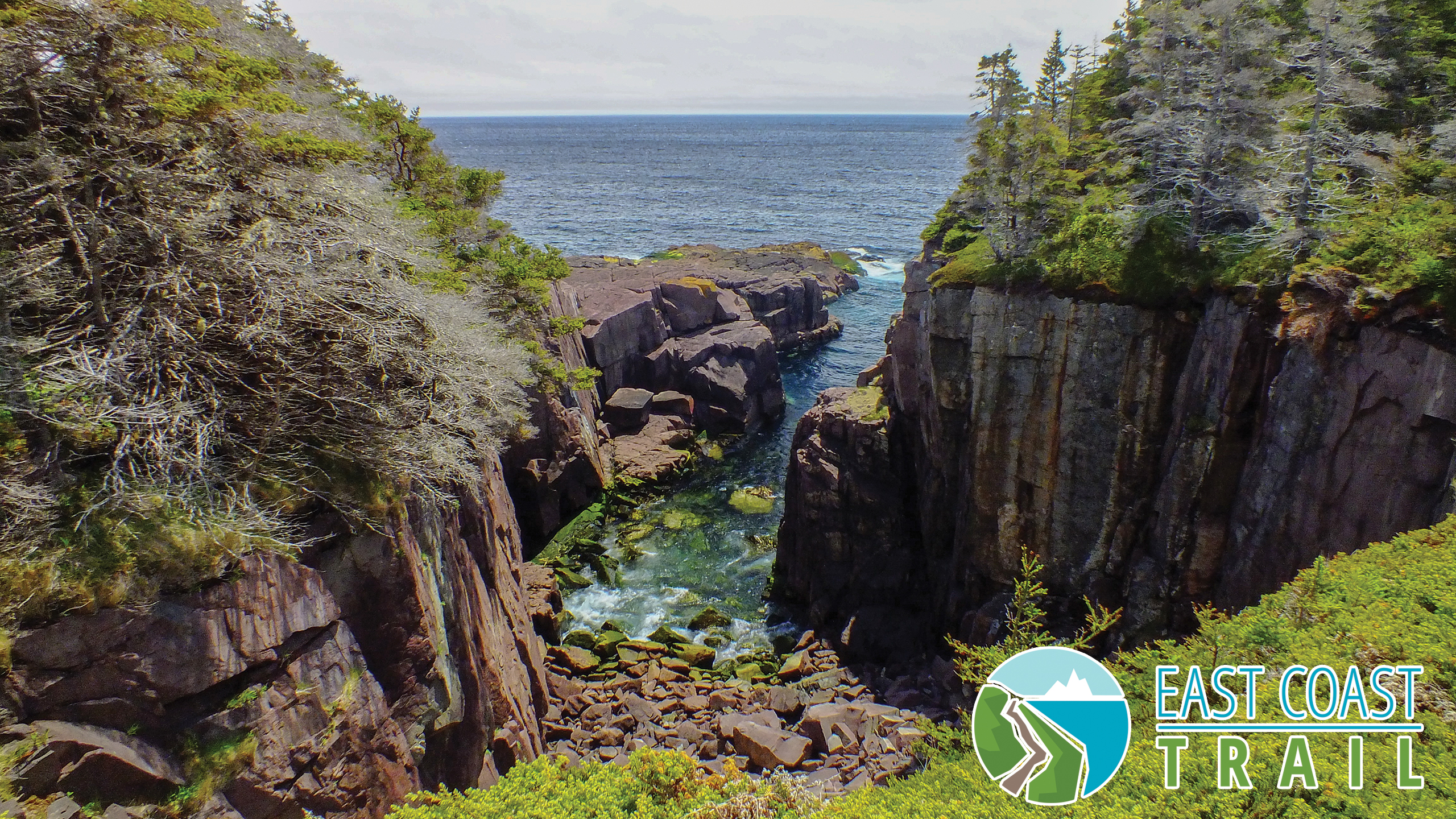
Motion Path is best described as sweeping. It is a landscape dotted with erratics – large randomly placed boulders deposited by glaciers and “puffin earth” (peat moss heaths and bogs) – with very well worn and easily followed foot trails that lead to high headlands with switch back descents over unique geological formations.
You will see whales and gannets during the summer season with ever present bald eagles overhead. Diligent (and quiet hikers) may also see some of the numerous foxes that have dens along the trail as well as coyotes that are increasing in numbers every year. Moose can also often be seen along the tree line in early morning and late in the evening.
Lucky winter hikers may see snowy owls and ptarmigan and the incredible rafts of eiders ducks just offshore feeding on mussels and periwinkles. These eider rafts can number from a few dozen to a thousand or more birds and when close to shore they make a sound very similar to someone using an old “make or break” dory engine. This is in addition to the turrs, dovekies, pigeon guillemots and razorbills that frequent the inshore waters in the multitudes.
The hiking along the coast is easy until you climb Burkes Head and The Tolt (in Newfoundland English, the word Tolt is used to describe the highest point of land in an area).
Camping Site
There is an undeveloped camping site located at Miner’s Point. This site has a couple of drawbacks: there are a limited number of choice tent sites (no platforms) and when the wind is off the water it can be uncomfortably exposed. The shortcomings are more than made up for however by the close proximity of an excellent water source, soft but elevated and well drained ground for tents and the sheer beauty of a campsite surrounded by stately birch. Summer campers will fall asleep with the sound of the wind rustling through their leaves.
 The intersection between Motion Path-Shoal Harbour Road-Spout Path is approximately two kms from the Miner Point campsite. The entrance to the Spout Path will be to your right. Please take your time because it can be confusing. If you turn left you will find yourself in a dead end clearing popular for local camping and bonfires with a small memorial. Turn right but go to far and you will find yourself on the bone jarring Shoal Bay Path ATV trail heading out towards Goulds.
A gentle 1km walk through the woods will bring you to the Queens River Flats. This is an idyllic scene with its flat sloping rocks, waterfall, calm water and surrounding forest. Queens River is most amazing when the humpbacks are in and they are using the shallow waters to hunt capelin and herring while hundreds of gannets dive bomb from over head. Fall is mushroom season and the woods in this section will be golden with Chanterelles in September, Winter Chanterelles in September-October and Hedgehog and Sweet Tooth Mushrooms in October.
It is a relatively easy hike to the exposed headland of Long Point. This will be your first chance to see the Spout off in the distance. Long Point is home to ravens and there is a well established fox den in the woods, so keep an eye out.
Thick Forest
The next two kms will take you through a thick forest of mixed birch and coniferous trees. This is an area where caution is advised as the path is ‘rooty’ with lots of rocks and can be a real ankle turner – especially for hikers that are tired. The woods in this area team with ruffed grouse, snowshoe hare, moose, lynx, coyote and numerous species of birds. Hikers will hear the spout blow as they get closer. In the spring the plume can be impressively high while during summer it can be tiny.
An established campsite with an outdoor toilet and five tent platforms and space for more tents on the ground is located 600 metres south of the Spout at Little Bald Head. It is sheltered and has a good supply of water – a great place to spend a night before returning to Petty Harbour or continuing the 11 kms south to Bay Bulls. Hike and enjoy all the trail has to offer.